Sunday, 23 September 2012
Sunday 23 September
The day started bright but very slowly, cloud cover increased from the south as the remains of
tropical storm Nadine moved up. It was not unduly warm, 15C / 59F. We were off to a major
undertaking for any visitor to Vlieland: Round the Hors.
The Hors (not horse) is an abbreviation of Vliehors, the large plain of sand on the southwestern
end of the island, ending on the Eyerlandse Gat, the sea narrows separating Vlieland from
its southern neighbour, Texel. The Dutch pronounce the latter island’s name as Tessel. Very
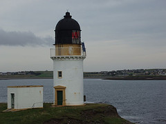
prominent is the lighthouse on Texel’s northern end, near the township of De Cocksdorp.
There is a seasonal ferry between the Vliehors and Texel, but it does not run on a Sunday.
It is the terminus for the Vliehors Express, which starts at the Posthuys and the Strandhotel,
6 miles to the north. The Vliehors has been in use as a military shooting range for decades,
and is only open for the public over the weekend. Even then, you have to exercise caution.
Spent ammunition, sometimes still live, litters the interior of the range. NATO airforces
use “Cornfield” to fire on defunct tanks.
We cycled to the Army Camp at the final dune crossing on Vlieland, referred to as the Lifeboat
Path, as the lifeboat used to be launched from there. Nowadays, the KNRM lifeboat “Graaf
van Bylandt” is stationed in the marina, a mile east of Oost Vlieland village. We reached the
crossing after a ride of 6½ miles through the dunes at 11am. We then turned south and walked
along the North Sea tide line. I think it is about 40 years since I last circled the Hors – I had
visited the area around the Lifeboat Path, known as the Meeuwenduinen (which commence at
the Posthuys, a mile and half to the north), many a time. The airforce observation tower was
still there, as was the sailor’s refuge. The refuge, built in 1890, stands 4 miles south of the
crossing, and used to be there for survivors of shipwrecks – a common occurrence in days gone
by. Nowadays, it is used to gather flotsam and jetsam: fish boxes, wood, signs, you name it,
it’s there. It has certainly cleaned up the place, as it used to be full of garbage. The Vliehors
Express calls round on its run to the Texel ferry, to show people. We proceeded south, but then
ran into a few problems; the tidal conditions create sandhooks, which appear to offer passage
– but do not. The gullies are 3 to 6 feet deep, and cannot be forded. They also change position.
I was aware of this problem, but did get caught out. Had to double back about a quarter of a
mile, then crossed straight over to the ferry stage. This is a rickety, wood-built affair, which the
Vliehors Express backs onto, in order to permit passengers to walk onto the ferry. This appears
to be a very simple affair, but I could only see it from a distance, due to another tidal sandhook.
That was the point where we had a cuppa, before heading northeast. Meanwhile, the cloud was
increasing, and a cold easterly wind had blown up. In order not to be disoriented, I used my
GPS and followed the tracks of the Vliehors Express. After another cuppa on the southern most
range of dunes in the Vliehors, we headed northeast towards the shooting range proper, where
all the wrecks of tanks sit. I even found an unexploded rocket stuck in the mud. DO NOT TOUCH
it screamed at me. I know the drill. I then headed for the on-ramp for tanks near the military
base. Not quite the right location; I had to circle the base perimeter fence in order to return to
the bikes. The northeasterly wind had become very strong, and it took me a long time to return
to the Ankerplaats. I was so absolutely knackered that I had to stop three times (in 6 miles) to
get my breath back.


Subscribe to:
Post Comments (Atom)

No comments:
Post a Comment